Description
It is a regional initiative promoted and sponsored by the Global Soil Partnership, with the participation of CIAT, EMBRAPA and 20 national institutes from Argentina, Bolivia, Brazil, Chile, Colombia, Costa Rica, Cuba, Dominican Republic, Ecuador, El Salvador, Guatemala, Honduras, Mexico, Nicaragua, Panama, Paraguay, Peru, Suriname, Uruguay and Venezuela.
Its objective is to develop a modern soil information system that can guide the sustainable use and management of soils, as well as help improve food security, adapt to climate change, provide environmental services and reduce poverty.
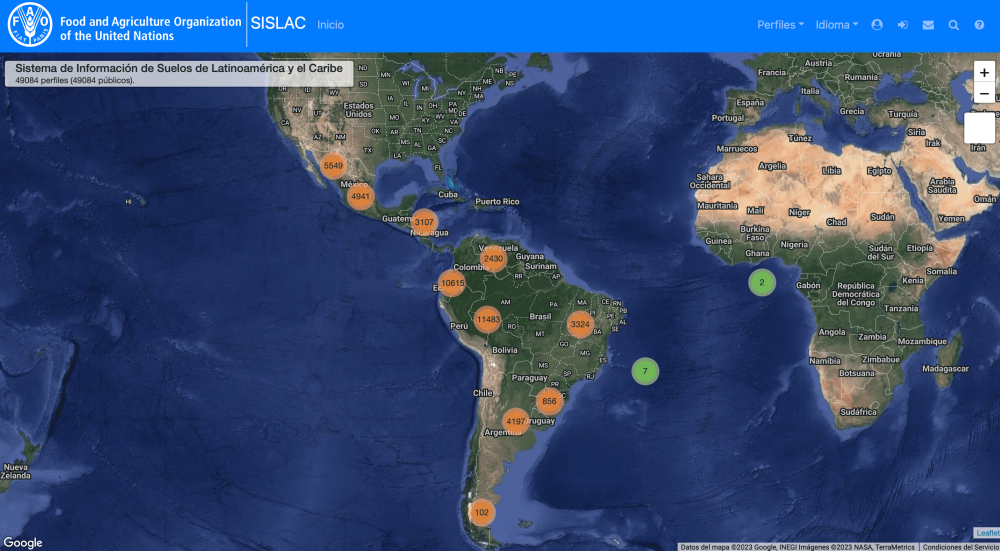
The system will be developed using state-of-the-art Digital Soil Mapping methods and tools. The first phase, under CIAT leadership, involves the rescue, harmonization, and storage of historical soil profiles in a regional database, which currently contains 6100 profiles, as well as the development of a regional soil classification map at a scale of 1:1,000,000 using national soil maps and the WRB soil classification system.
The second phase, carried out by EMBRAPA in collaboration with INTA, includes capacity building and formal training in digital soil mapping and the development of soil property maps at national and regional scales. The participation and leadership of the 20 countries participating in SISLAC are key to achieving this goal.
At present, the SISLAC website is not open to the general public: access to the data requires user registration and a statement of intended use.
Institutions:
Authors:
- FAO: Organización para la Agricultura y la Alimentación
Resultados:
Thematic Areas:
Languages:
- Español
Beneficiaries:
- Researchers
- Agricultural producers
Countries:
- Latin America (countries)
ÚNETE A LA CONVERSACIÓN:
Si quieres unirte y participar presiona "Quiero Colaborar"; si aún no tienes tu cuenta presiona "Registrarme".